LOCAL HISTORY: History of Carlingford Lough is a tale of triumph and tragedy


The Old Irish name for the inlet was Suám Aignech (swift sea-channel or fiord) while Carlingford is of Viking origin, meaning ‘lake of the hag-shaped rock’. Monuments such as Clermont Cairn attest to prehistoric settlers in the area. The Early Christian period saw several monastic settlements becoming established in the region, Kilbroney on the northern shore, Killanansnamh in the townland of Cornamucklagh on the southern shore and the important monastery at Killeavy, at the bottom of Slieve Gullion.
The sea inlet attracted the attention of the Vikings in the 9th century. They gave the inlet a new name and appear to have used the area as a base from which to raid other parts of Ireland. In 841, for example, Tristledermot in Meath was destroyed by the Vikings of Narrow Water (Caol Uisce). They also attacked Armagh and, in 923, the monastery at Killeavy was raided.
Advertisement
Hide AdAdvertisement
Hide Ad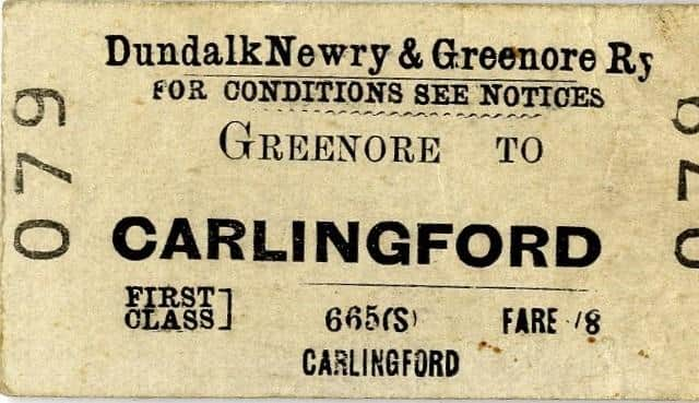
The strategic significance of Carlingford Lough was also recognised when the Anglo-Normans arrived in Ireland in the late 1100s. Understanding the importance of fortresses in defence, two castles were constructed at the mouth of the lough; one on the northern shore and another on the southern shore, ensuring Normans had control over access from the sea. On the southern shore, King John’s Castle was constructed, which was named after John who visited Carlingford in 1210. A town grew up around the castle which became the main port on Carlingford Lough.
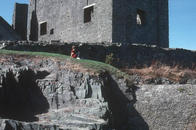
Greencastle was constructed on the northern shore during the mid-13th century. Greencastle was captured in 1316 by Edward Bruce and further attacks meant it had fallen into disrepair by the 15th century.
It was eventually granted to Nicholas Bagenal in 1552, along with the lands of the former Cistercian abbey at Newry and the Dominican priory at Carlingford. This grant paved the way for Newry to become the largest urban centre in the Carlingford Lough area.
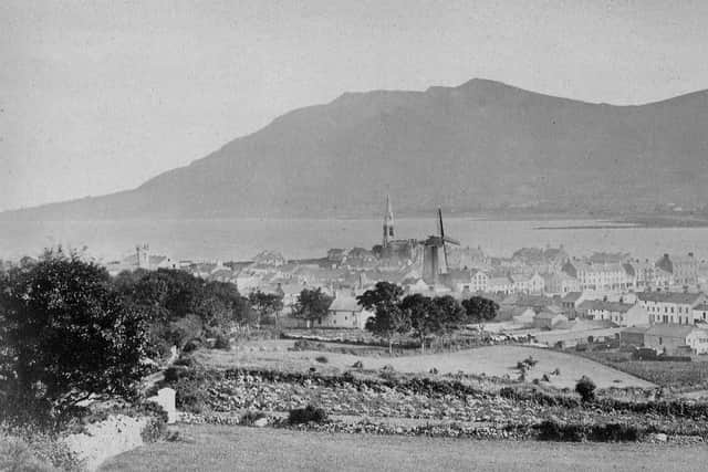
In the years after the opening of the Newry Canal in 1742, Newry replaced Carlingford as the main port on Carlingford Lough and became the fourth largest in Ireland.
Advertisement
Hide AdAdvertisement
Hide AdDevelopment of Warrenpoint and Rostrevor as highly-successful holiday destinations was stimulated by the opening of the Newry-Warrenpoint railway in 1849 – and the opening of the Dundalk, Newry and Greenore Railway in the 1870s meant the area was linked to a ferry service to Holyhead from Greenore.
Despite its appeal to shipping, Carlingford Lough is hazardous to ships and has seen various disasters over the years. The most famous was the Connemara/Retriever disaster in November 1916, which resulted in the death of 94 people.
Since the end of World War II, there have been many changes in the Carlingford Lough area – especially with the closure of the local railways in the 1950s and 1960s and the moving of ship-handling facilities from Newry to Warrenpoint in the early 1970s.
Tourism is now a big factor in the local economy and the lough was designated as a Marine Conservation Zone in 2016.